|
The
I-94 Corridor provides unprecedented economic development potential for
the Townships and Cities of Hartford and Watervliet. Currently, this
area mainly contains agricultural uses, vacant land and interspersed
residential and commercial lands. Over the next several years, with
effective planning and the support of local property owners and
citizens, this area can become the region’s premier light and heavy
industrial employment center.
The I-94 Corridor Economic Development Plan represents
a collaborative effort that spans the border of two counties and
intersects four communities. The counties and municipalities have
created and supported this collaborative effort for the benefit of the
region. Hartford and Watervliet Township
and the cities of Hartford and Watervliet, developed this plan
for the future of the I-94 Corridor. The Corridor currently serves as
the primary transportation route between Chicago and Detroit.
Interstate 94 represents one of the most heavily traveled highways
within the State of Michigan, allowing people and goods to easily
commute between these prominent cities.
While individual communities and organizations may
define and implement economic development differently, in the Hartford
and Watervliet area common goals have emerged. The purpose for economic
development planning is to forward policies, programs, and projects
that encourage economic opportunity for all. This encompasses job
creation, public and private sector investment in the communities, and
an overall enhancement of quality of life. Many facets of life are
impacted by economic development activities, jobs where people work, to
the commercial and industrial tax revenues that help pay for schools,
public safety, and roads.
|
Click on picture to
download the proposed
I-94 Corridor
Economic Development Plan 2008
Prepared by
Abonmarche
Adobe Reader is required to view this
file. Download the current FREE version of Adobe Reader at
www.adobe.com.
Very large .pdf file – worth the wait with
high-speed DSL (est. 1-1/2 minutes)
or Cable. Can
be downloaded with slower 56k dialup modems, but not recommended due to
size of file.
List of Maps noted within plan
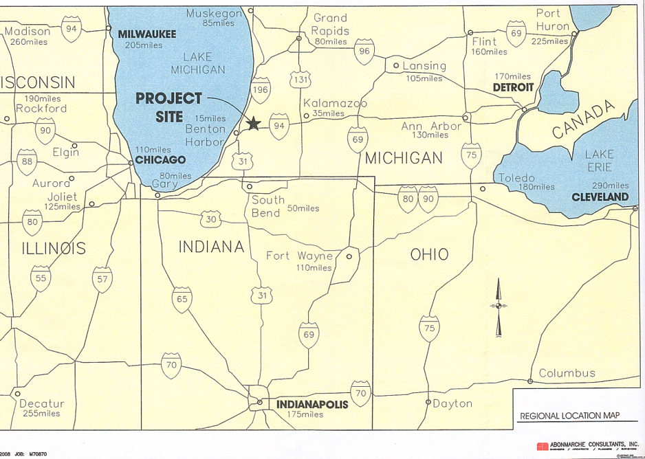
Regional Location Map
– page 5
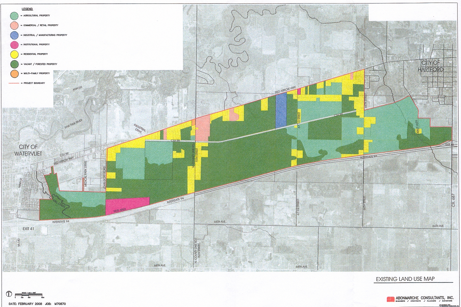
Existing Land Use
– page 17
Existing Zoning Map –
page 18
Future Land Use –
page 39
|